

0 %of the map revealed
👆 Swipe over the clouds
☁️ Your travel diary that writes itself

How much of my area do I really know?

The world is covered in clouds. Wherever you step, they disappear for good. KumoTrip records every walk, bike ride and car trip by itself and shows you what percentage of your district, country and the world you have already explored.

Free onGoogle Play
QR code to downloador scan it with your phone

You just walk. KumoTrip writes down the rest.

Nothing to switch on, nothing to save. Just keep your phone in your pocket.

1

📲 Install

Get KumoTrip from Google Play and allow location access. There's nothing else to set up.

2

🚶 Head out

KumoTrip recognises whether you walk, cycle or drive and records the route by itself – while saving battery.

3

☁️ Watch the clouds disappear

Every step reveals a piece of the map. In a few weeks you'll see exactly which areas you know and where you have never been.

What is KumoTrip?

KumoTrip is an Android app that records your trips by itself and turns them into a game. At the start, the whole world map is covered in clouds. Wherever you walk, cycle or drive, the clouds clear for good – like the fog of war in strategy games, but in the real world.

Not sure where to go? The map also shows coloured dots for places you haven't discovered yet – castles and chateaux, lookout towers, waterfalls and other sights around you. Just pick one, head out and add it to your collection.

The world is split into squares of 80 × 80 metres. Every revealed square counts: KumoTrip uses them to calculate what percentage of your district, region, country and the whole world you know, and you compete with other players by them in the leaderboard.

  • 🗺️ Map – routes coloured by whether you walked, cycled or drove; clouds, heatmap and photos on the map
  • 📖 Diary – every day with distance, photos and discoveries, personal records and challenges
  • 🏆 Leaderboard – who has revealed the most squares, places and countries
  • 🌍 World – blank map of visited countries, % of the world explored and statistics of your countries
  • 💰 Finance – holiday budget, currency conversion and a daily limit
  • 🏰 Collection – castles, churches, lookout towers, waterfalls and other real places that are logged automatically
🗺️

Where have I been?

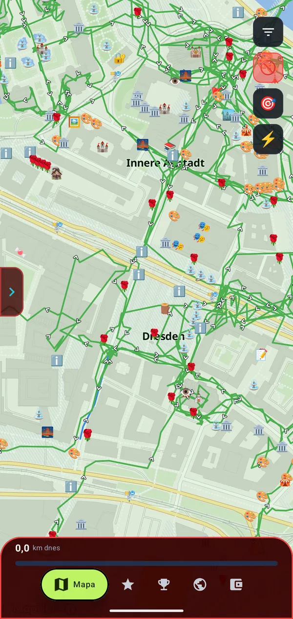
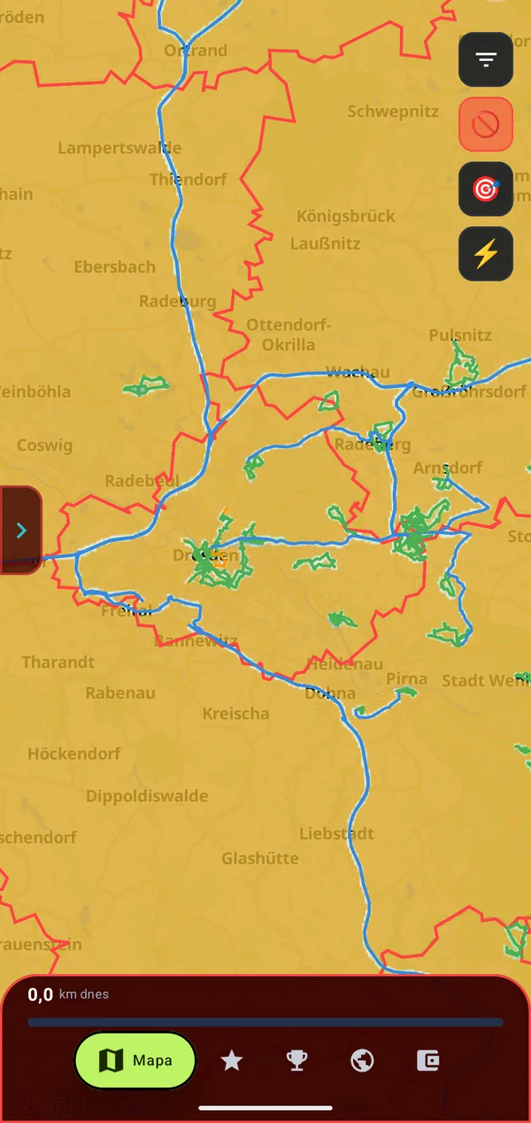
The map shows all your routes at once. The yellow fog disappears only where you really walked or drove, so you can see at a glance which streets and villages you don't know yet.

  • Line colour = how you travelled. KumoTrip recognises by itself whether you walk 🟢, cycle 🟠 or drive 🔵. You mark train rides 🟡 yourself – even afterwards in the route detail.
  • The world is split into 80 × 80 m squares. Every square you walk or drive through is revealed – and that's what you compete in with others in the leaderboard.
  • Discovered places as icons right on the map – castles, churches, crosses, galleries, viewpoints…
Map of Dresden with walking routes and icons of discovered places
Yellow fog revealed only along walking and driving routes
🔥

Where do I go most often?

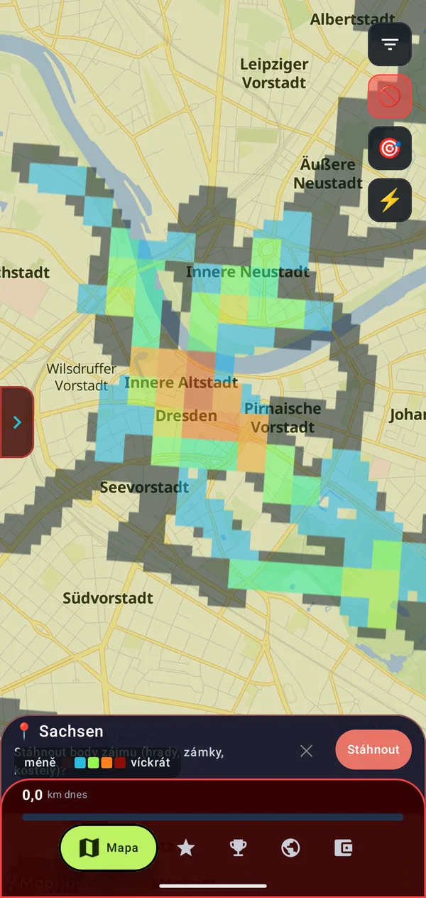
The heatmap colours the squares by how many times you have passed through them. Blue means a few times, green and orange more often, red means you go there all the time.

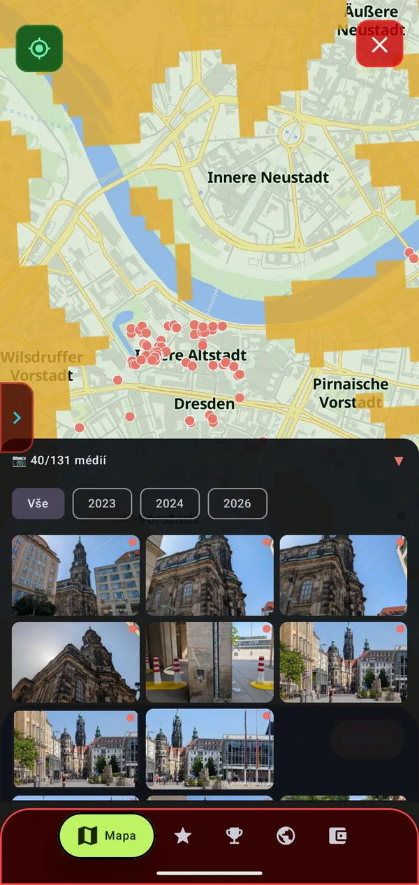
  • Photo map: red dots show where you took photos. The photos from that spot open below and you can filter them by year.
Heatmap of Dresden from blue to red
Photos on the map where they were taken
☁️

What percentage of my district do I know?

Tap a district to see its area, population and what percentage of it you have explored. Plus how many places it contains, how many fog tiles you have revealed and how many places of each category you have found there.

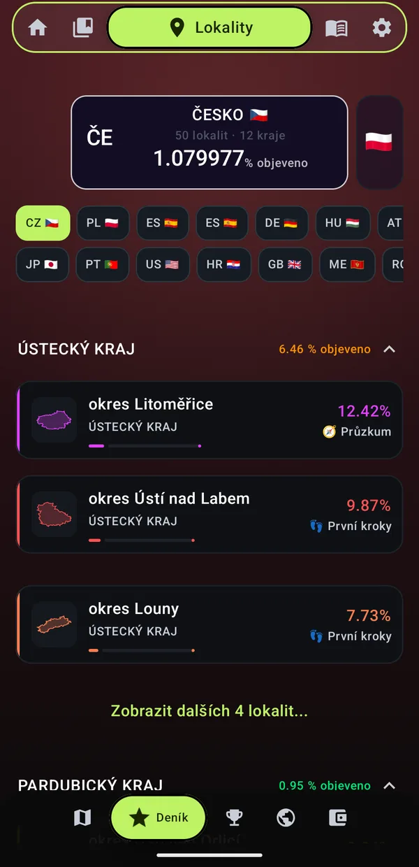
  • Overview by country and region – a percentage for every region, and for every district a percentage and a level (“First steps”, “Scouting”… up to “Conquered”)
  • The whole Czech Republic at 1.08 % – that counts too 😉
Dresden: 12.26 % explored, 1029 places, 6460 tiles
Ústí region with percentages and levels
🌍

Which countries have I visited?

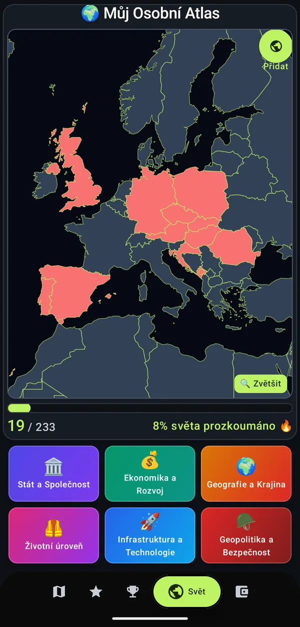
Every country you visit is drawn on a blank world map automatically. Countries from trips before KumoTrip can be added by hand – by tapping the map or from a list. Below the map you see how many of the 233 countries you have and what percentage of the world you have explored.

  • 6 areas of statistics about your countries: state and society, economy and development, geography and landscape, standard of living, infrastructure and technology, geopolitics and security
Blank map with visited countries: 19 of 233 countries, 8 % of the world
👑

What if I ruled every country I've been to?

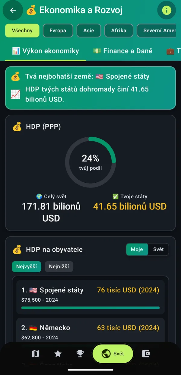
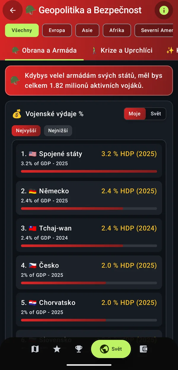
The atlas tells you which of your countries is the richest, how much they earn together (and what share of the whole world that is) and how many soldiers you would command.

  • Rankings of your countries – GDP per capita, military spending and more, highest or lowest first
  • Mine / World switch and a continent filter
GDP of your countries: 24 % of the world
If you commanded the armies of your countries: 1.82 million soldiers
🗓️

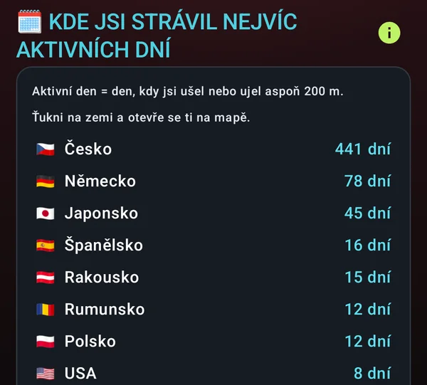
In which country have I spent the most days?

KumoTrip counts the active days you have spent in each country – days when you covered at least 200 metres there. Czechia 441 days, Germany 78, Japan 45… Tap a country and it opens on the map.

Active days by country: Czechia 441, Germany 78, Japan 45
🧭

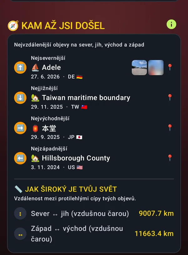
What's the furthest north I've ever been?

KumoTrip finds your northernmost, southernmost, easternmost and westernmost discovery – including the photos you took there. And it calculates how wide your world is: how many kilometres as the crow flies separate your northernmost point from the southernmost and the westernmost from the easternmost – from Florida to Japan it's over 11,600 km. Tap a place and the map takes you there, tap a photo and it opens.

Extreme points: northernmost Adele (DE), southernmost Taiwan, easternmost Japan, westernmost USA; north↔south 9007.7 km, west↔east 11663.4 km
🏰

How many castles and churches have I collected?

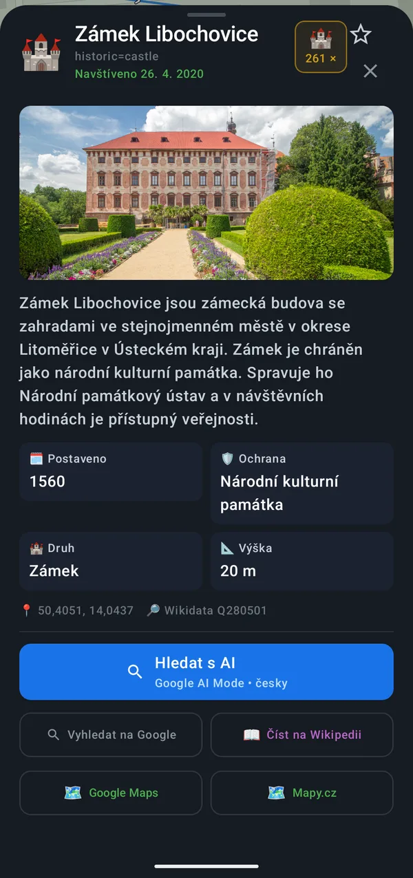
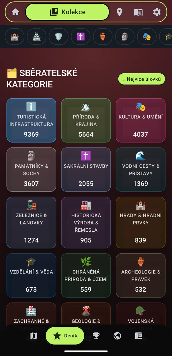
Places are added to your collection automatically when you walk or drive past them. The Collection shows how many you have in each category – from tourist infrastructure and nature through monuments, railways and castles to archaeology and geology.

  • For every place a photo, description, year built, heritage protection and the date you were there
  • One tap to Wikipedia, Google, Google Maps, Mapy.cz or an AI search
  • ⭐ Tap the star to save a place to your favourites
Place detail: Libochovice Chateau
Collection categories with place counts
✝️

How many wayside shrines have I passed?

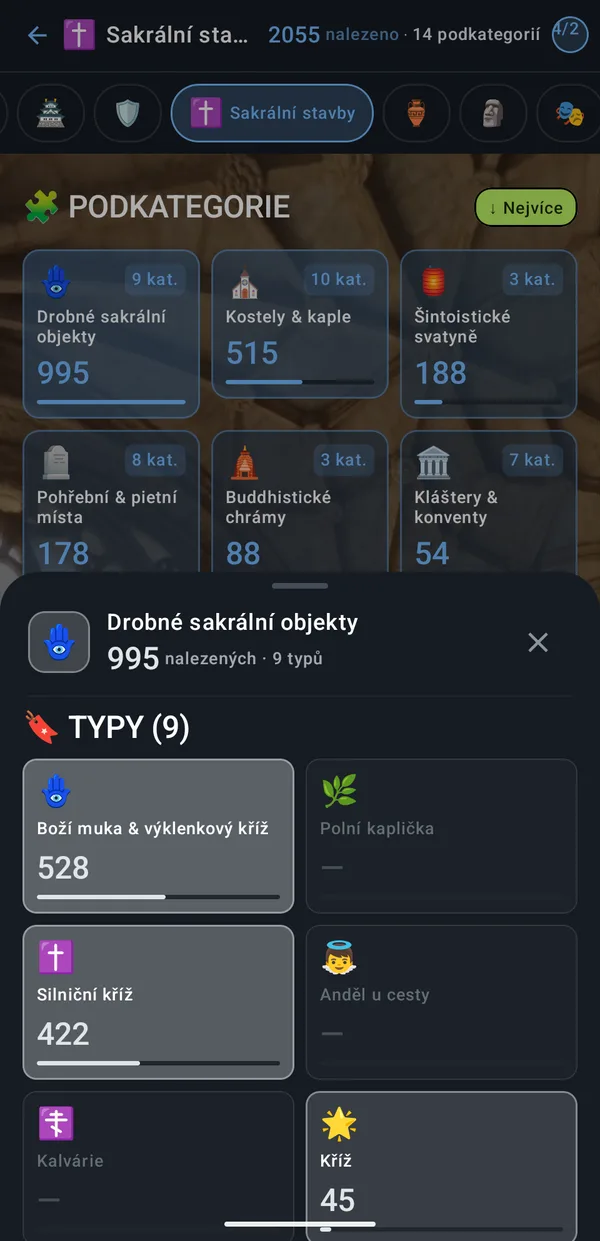
Each category is divided further. For religious buildings you see churches and chapels, monasteries, memorial sites and small religious objects separately – including, say, 528 wayside shrines and 422 roadside crosses. Types you don't have yet are greyed out, so you know what to look for.

Subcategories of religious buildings with counts
🏆

What was my longest trip?

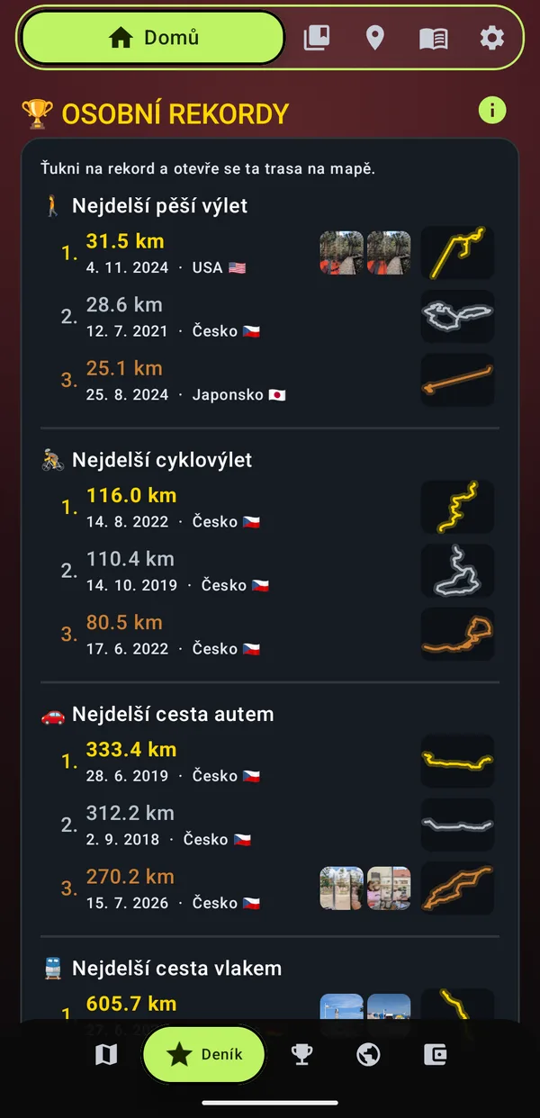
Your three longest daily routes on foot, by bike, by car and by train – with the date, country, route shape and photos from that day. Tap a record and the route opens on the map.

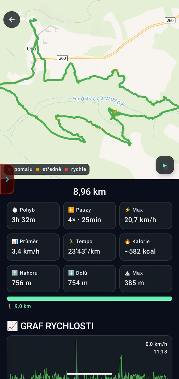
  • Route detail: moving time, pauses, average and top speed, pace, calories, metres up and down and the highest point
  • Speed chart and the route coloured by where you went slow and where fast
  • ▶ Replay – relive the trip
  • Mode editing – relabel part of a route as walking, cycling, driving or train
Personal records on foot, by bike, by car and by train
Route detail 8.96 km with statistics
📖

Where did I actually go last summer?

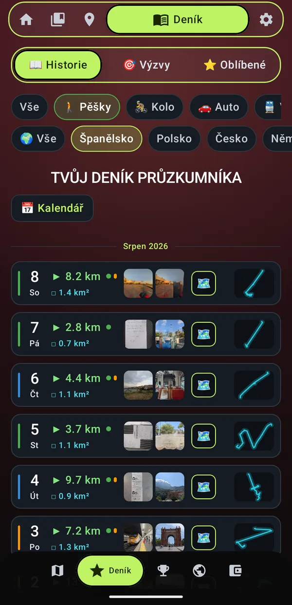
The diary shows every day: how far you went, how much of the map you revealed, photos from that day and the route shape. Coloured dots tell you whether you walked, cycled, drove or took the train that day.

  • Filter by mode – only walks, only bike rides, only drives or only train rides
  • Filter by country – e.g. all your days in Spain
  • Calendar – jump to any day; filters can be combined
  • Challenges (daily, weekly, monthly) and Favourite places right next to it
Diary: walks in Spain with photos
🏁

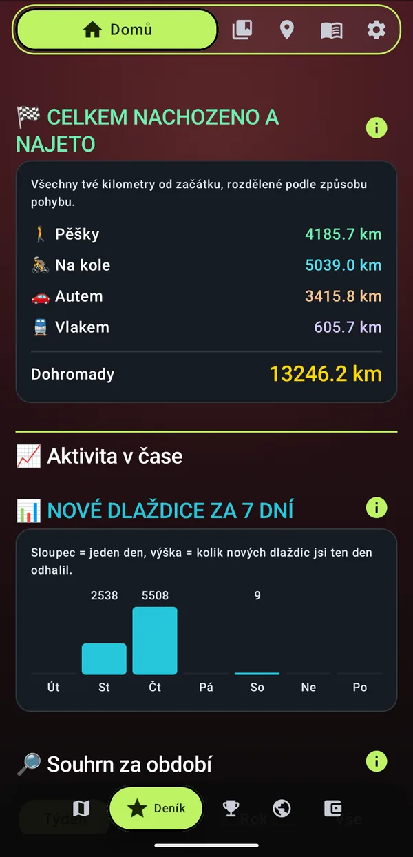
How many kilometres have I covered?

All your kilometres since day one, separately on foot, by bike, by car and by train – and in total. Below, a chart of how much new map you revealed in the last 7 days.

Lifetime distance: 13,246 km
💰

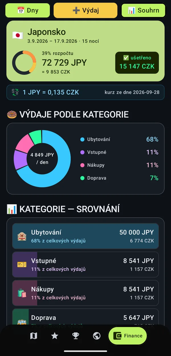
How much did my holiday cost?

Create a trip with a budget and log your expenses. KumoTrip converts foreign currency at the exchange rate, shows how much of the budget is gone and how much you have saved, and sorts expenses into categories.

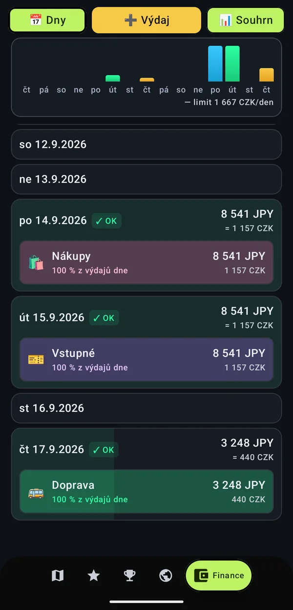
  • Daily limit – the chart shows which day you spent more
  • Receipt photo and the place of purchase on the map
Budget of a trip to Japan
Expenses by day with a daily limit

🏅 What rank have I earned?

Every discovery earns you points, and with them you rise through the ranks. 26 ranks: from stable boy through knight and king to creatures of folklore and the old gods.

🧹 Stable boy→ ⚔️ Knight→ 👑 King→ 🦅 Emperor→ 🐸 Water goblin→ ☀️ Noon witch→ ⚡ Perun

👑 Which of us has revealed more of the world?

The whole world is split into 80 × 80 metre squares. Every square you walk, cycle or drive through is revealed – and the leaderboard shows who has the most. The top three stand on the podium.

  • 🟦 Tiles – 1 revealed square = 1 point, purely how much of the world you have uncovered
  • 📍 POI – who has discovered the most places, also within a single country
  • 🌍 Countries – who has visited the most countries
  • 🏆 Total – points for places, countries, districts, revealed fog and completed challenges
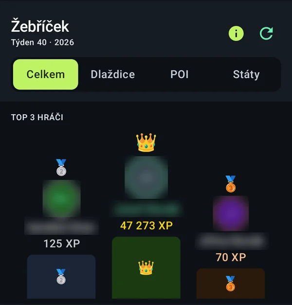
Leaderboard with the top 3 players on the podium

How far am I from the next milestone?

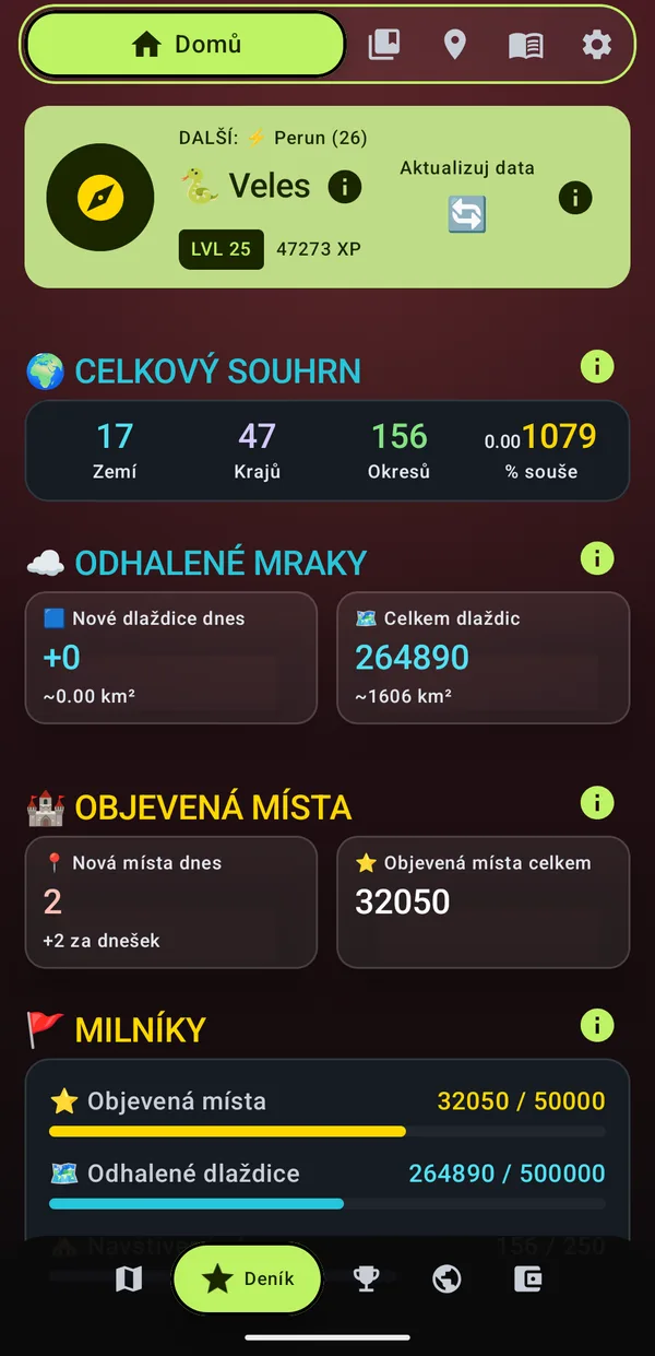
The Home tab shows your rank, level and points, how many countries, regions and districts you have visited and how far you are from the next milestone in discovered places and revealed map.

Home tab with the rank Veles and a summary
🎯

What should I discover today?

Every day a new expedition to a group of places near you. Completed challenges earn extra points.

⚡

How many places did I manage in a single day?

KumoTrip keeps your records and your longest streak of days in a row with a new discovery.

What else will it answer?

📊

Was this month better than the last?

A summary for the week, month or year, compared with the previous period right next to it.

🌙

What would my world look like from a plane?

Switch between a light, dark or aerial map and add hill shading.

💾

What if I change my phone?

Save the whole app – routes, fog, places and finances – into one file and restore it on your new phone exactly as it was.

📥

Do I have old routes in another app?

Import them as GPX and the clouds clear where you have been before, too.

🔋

Do I have to switch anything on?

No. KumoTrip recognises how you move by itself and saves battery while doing it.

Frequently asked questions

How much does KumoTrip cost?

You can download it for free from Google Play.

Won't it drain my battery?

Saving battery is KumoTrip's top priority. When you stand still, GPS almost rests, and KumoTrip adjusts how often it asks for your location depending on whether you walk, cycle or drive.

Where are my routes stored?

On your phone. Signing in with Google is optional: your routes and discovered places are never sent anywhere. If you sign in, only the nickname you choose and your leaderboard numbers go to the server. To move your data to a new phone, use the Full backup (ZIP file). Details are in the privacy policy.

Does it recognise train rides by itself?

It recognises walking, cycling and driving by itself. You switch to train with one tap and can also edit the route afterwards.

Does it work abroad?

Yes. The map, the collection of places and the percentages work all over the world, at home and on holiday.

How much of the map can you reveal? ☁️

Get KumoTrip for free – today's walk will already clear the first clouds.

Free onGoogle Play
QR code to downloadScan with your phone